Saturday, July 30, 2022

Hot Tip for Staying Cool

Find your bliss.

Finally, summer weather has arrived. Last winter when my furnace broke down I had no heat during the holiday storms, until my landlord finally installed a new high-tech, programmable thing that also has AC, or some sort of cooling function. I haven't really figured out how to set it, though. So far I've been making do by keeping the blinds closed and my apartment shut up while I'm out during the day, then opening up the door and windows and turning on fans to get a cross-draft when it's cooler in the evening. Most mornings I wake up at about 5am and open the door wide to let in some cool air. Since last week day-time temperatures have been in the mid-to-high 80's, though, and that isn't enough any more. I've figured out how to turn on the fan and cooling function on the new furnace (or whatever it is) but it hasn't been very effective. Sometimes it resets itself, and when I check it, I'll find the indoor temperature is set at 82F. I've had trouble sleeping a few nights. Last night I gave up and went out for a late-night stroll at about one in the morning. The night walk was a refreshing change, and it's nice being up early, but then I have to take an afternoon nap.

My best solution for over-heating is an old-fashioned red rubber hot-water bottle, which I fill up with cool water and leave in the refrigerator. Normally I use it for neck and back pain, or for any other sore, swollen joint, but it's perfect for a fast cool-down too. This morning I went for a 30-mile bike ride in the cool part of the morning, but my apartment was pretty warm when I got home around noon, and I was red-hot and dripping with sweat. After a cool shower and a nap, I woke up with a stiff neck and mild headache developing, which can be symptoms of dehydration or heat stress. A cool drink and the cold pack on my head, neck and shoulders cleared that up immediately.

Sunday, July 17, 2022

Eco Adaptations

We may soon see the end of drive-through fast-food as we know it around here - which is fine with me, I hate drive-through lines - but I don't know how Starbucks can go on without super-sized grande plastic drink cups. Seriously, fast food places are going to have to change their business model, and the whole atmosphere of their stores. In the past few years, single-use plastic shopping bags have been outlawed, and non-biodegradable food containers and utensils are going soon - plastic knives, forks, spoons and beverage straws, and plastic drink cups, styrofoam cups, bowls and take-out dishes.

I carry a bamboo spork and knife in my purse, and I guess soon I'll have to bring along a re-usable cup, too. I keep shopping bags in my car, and bought some re-usable mesh produce bags, which I usually forget to carry with me (along with my grocery list, which I leave behind on the kitchen counter).

The plastic bag-ban has been inconvenient because I've always used plastic grocery store bags for my kitchen garbage, rather than buying disposable plastic bags to fill up with garbage then throw away. It takes about a week for me to fill one, mostly with coffee grounds and fruit and vegetable scraps, which are too wet to put in a paper bag. Now I'm using plastic bread or produce bags, but I'll have to find a better solution soon.

In my old job we sold large, decorative re-usable shopping bags for $1.99 or $2.99 or so, and we charged $.08 for big brown paper shopping bags at the cash registers - a state-mandated fee. Many customers argued about the bag-fee, and sometimes when I asked a customer at check-out if they wanted a shopping bag for eight cents, they would say no. Then they would watch the register display as I totaled their sale and ran their card. At the moment the charge went through, they'd say "oh wait, you know, I do need a bag . . ." I once heard a manager ask a customer "do you have eight cents?" but usually I just gave them the bag for free. In fact, I got so tired of the hassles that I stopped asking and charging for bags at all. Over time I single-handedly messed up the store's inventory and re-ordering, and we ran out of shopping bags just in time for the holiday shopping season, except for the expensive decorative gift bags. I'd like to think this made customers regret giving me trouble, but I doubt it.

I'm glad I don't work retail anymore. But I suppose next they'll outlaw bubble wrap.

Friday, July 8, 2022

Centennial Trail - 4th of July

Nakashima Barn
Unexpectedly granted a four-day weekend for Independence Day, I took off for an impulsive and not-very-well-planned ride on the Centennial Trail in Snohomish County, about 50 miles south of Bellingham. The Centennial Trail is an almost-30 mile paved rail-trail that runs between the town of Snohomish at the south end, through Arlington, and almost to the Skagit-Snohomish county line at the north end.

The trail starts at the Nakashima Barn, which is found after a long, meandering drive on Hwy. 9, through wooded country-side, past Lake McMurray. The barn is the last building remaining from the 89-acre dairy farm of the Nakashima family, who were forced to sell the farm in 1942 when they were relocated to an internment camp during WWII. The large family was split up, sent to different camps, and never returned to the county after being released.

I had researched the bike trail and the route to the ride start in advance, as I'd been meaning to try this ride for some time, then for one reason or another didn't go. Until Saturday morning, when I gathered up my maps and cue sheets, put my bike in the car, and headed south. Expecting a hot afternoon, I tried to start early, applying a thick coat of sun-block before leaving home. But I also brought along a rain jacket and long-sleeved shrug, which was lucky because the day was chilly and over-cast when I arrived at the barn a little before 11am.

I have ridden through this area a couple of times before. First was back in 2010 when I was returning from Bicycle Mechanic School in Ashland. I had meant to take Amtrak home but when I changed trains in Seattle I wasn't allowed to bring my bike on board. After some argument I got a refund for my ticket and set out to bicycle all the way to Bellingham. I cheated a bit and took my bike on the Swift commuter bus as far as Lynnwood. Then, without a good map of the area, I improvised a route by generally following Hwy. 99 generally northward. A long day, but I made it. The second time was in 2014 when I rode the Red-Bell 100 World Bicycle Relief fund-raiser, which was a much better planned and supported ride.

But much of the route I rode this time didn't really look familiar. True, a lot of the trail is a smooth strip of blacktop beside a mowed-grass equestrian path, bordered by green shrubbery and trees, which kind of all looks the same wherever you are. The Red-Bell 100 had a rest-stop in Arlington, at a city park with a band-stand or picnic shelter. I didn't spot it on my first pass through this time, because it was surrounded by vendors and buskers at a Saturday Farmer's Market, but I stopped for coffee and a snack on the return trip and then recognized the place. North of town, the route runs on wide paved sidewalks along a city street in an industrial/commercial area, with many newer apartment and condo developments that weren't there in 2014.

In Arlington a small bridge crosses over the confluence of the north and south forks of the Stillaguamish River, which creates some interesting currents, sand bars and log jams under the bridge. (This point is also about twelve miles down-river, or down Hwy. 530, from the little town of Oso, which was destroyed in a huge landslide in 2014.)

Pilchuk Creek, 7-8 miles from the barn

I rode about 17-18 miles, to somewhere past Getchell Road - the trail is pretty flat but there are some long, gradual up-grades that can get tiring, especially considering that I had only brought along one water bottle, and no snacks. By this point it was also getting warm and sunny enough to take off my jacket and long sleeves. So I turned back at the top of an up-grade and had an easy coast back toward Arlington for my rest-stop, making a 35-mile round-trip.

I feel a little guilty for driving 100 miles for a 35-mile bike ride, but it was good to have a change of scene for the holiday weekend. If I'd planned better and brought more food and drink I could have made the ride longer, and maybe even found some ride companions to carpool with me. Full round-trip ride would be 60 miles.

Next time.

Not the Farmer's Market, but there was a beer garden

Wednesday, June 22, 2022

After the Flood

Pink dogwood
Hovander Park is the loveliest place in Ferndale for a quick after-dinner walk or bike ride, especially if you include Tennant Lake and the trail along the river to Slater Road.

The gardens have suddenly recovered this week, after the flooding last winter, although many of the farm animals are gone now. The chickens, ducks and geese are still there, and some rabbits, but the goats and their pens are gone. In the old days, the park also kept sheep, cattle, pigs, peacocks, pheasants and other game birds, but those have been gone for years. The Scottish Highland Games will be held at the North Bellingham Golf Course in the future, in pouring rain this year. This will give the park a chance to recover - marching massed pipe bands are hard on the lawns and shrubbery.

This weekend's weather forecast is for our first hot spell of the summer - temperatures in the mid-70's, up to 80 even. Unfortunately, even though I haven't been riding very much I somehow developed a bit of saddle-soreness which I have to let heal up before attempting a long ride. At least I've finally got my new bike adjusted comfortably, apart from the chafing . . .

So in the meantime I'll just enjoy the flowers, on foot.

Highwater mark on 11/11/21


Wednesday, June 15, 2022

Cap Sante - Memorial Day Weekend

Summit of Cap Sante
May and June have been moody months, with days of drenching rain and wind, then a sunny break, then more storms. On Memorial Day weekend, for a change of scene, I took a car trip to Anacortes and spent a day walking around the parks and waterfront.

It's been five years already since the summer I worked at Island Bicycles in the town of Friday Harbor on San Juan Island. That summer I passed through Anacortes at least a couple of times a month, on my way to or from the ferry landing. I bicycled and/or rode the bus between Ferndale and Anacortes and by the end of the summer I was in the best shape of my life. But that was five years ago, and now I'm not.

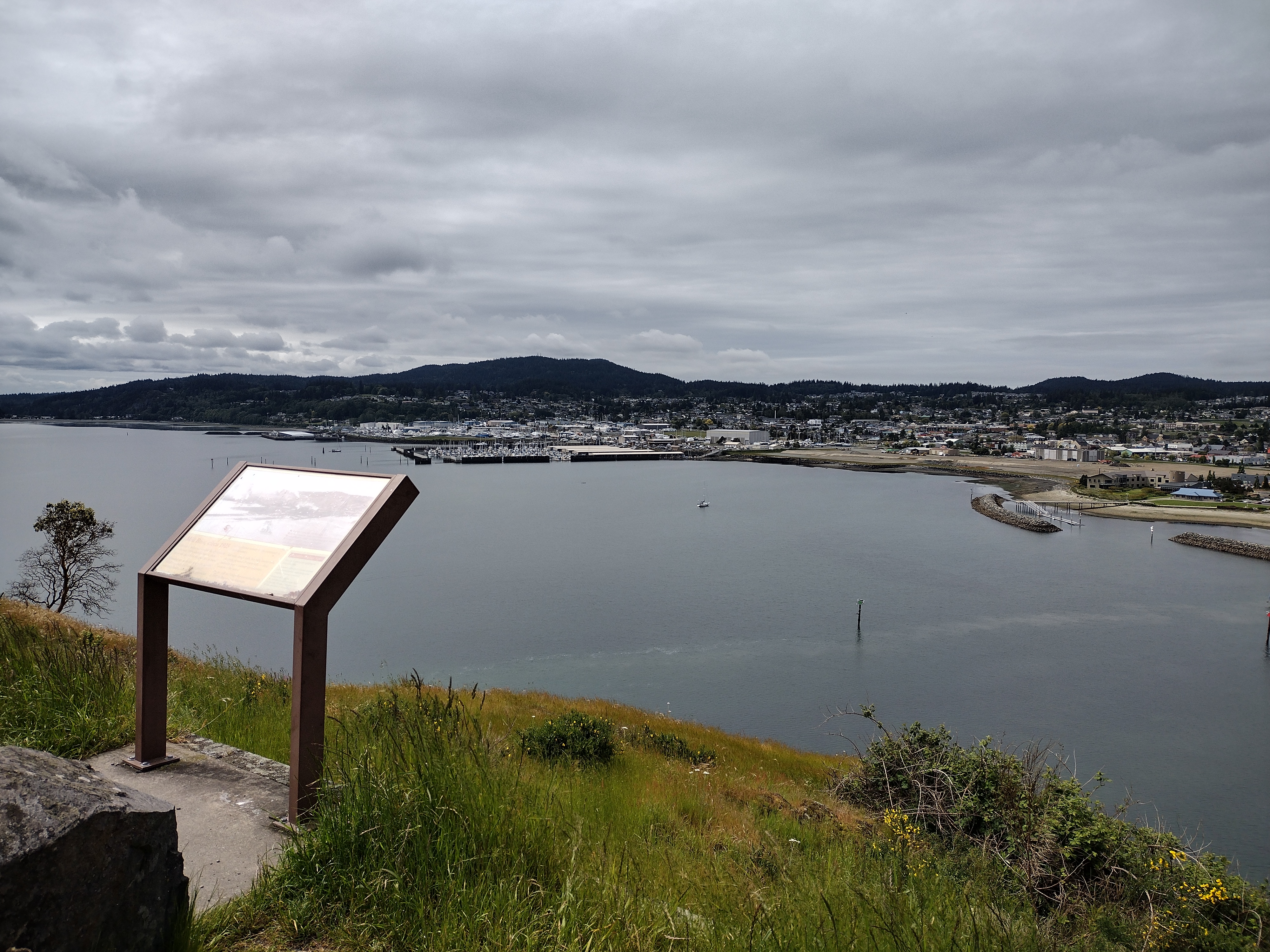
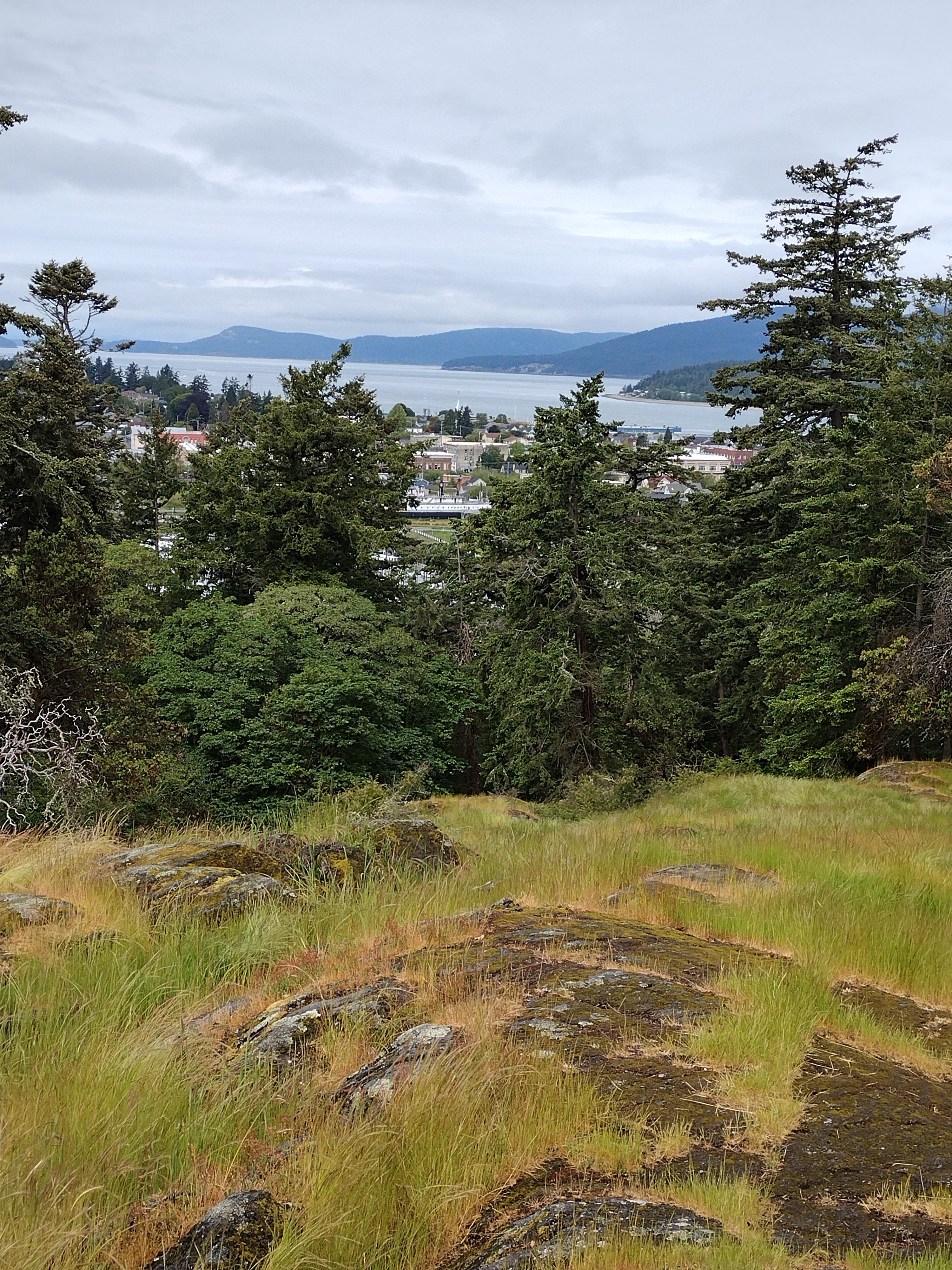
Back then I would walk or ride my bike on the flat land around downtown, looking up to admire the rocky top of Cap Sante. On foot this time, I decided to climb up to the top - only a few hundred feet. I walked the paved pathway by the marina, out to a viewpoint below the bluff. A couple of short cement stairways lead uphill from the paved footpath, which I assumed logically would put me on a trail all the way to the top. But in the pandemic years, the steep hillside has been heavily used by some very enthusiastic frisbee-golf players. Much of the understory plants have been trampled, leaving large areas of bare dirt between the frisbee targets. Although it was hard to distinguish any particular path, I thought as long as I kept going up I would have to arrive at the top eventually. The hillside got steep enough that I had to look for footholds on roots and rocks, and catch on to tree branches for balance. Then I came to some cracked, jagged bare granite where I wedged my feet and fingers into vertical gaps, climbing twenty or thirty feet to the top of the rocks. Once there I scanned the view of the bay and the town, and also . . . a small parking lot with a bench and viewpoint marker. A narrow paved road goes up the far side of the bluff so you can just take the easy way and drive up to the top.

Panorama view from the top of Cap Sante:

I'd brought a map and compass with me, just to keep oriented, and was surprised to find that the town of Anacortes is actually south of the peak. The shoreline curves and winds around much more than it seems, at least if you're used to thinking in terms of highways running north-and-south.

After admiring the views and exploring around the rocky top of the bluff, I found a gravel trail leading downhill through the woods, which came out by the yacht club - a much easier route than the one I'd taken on the way up. From there I walked around the marina a bit more, then had a very filling fish & chips lunch at The Cabana - under an umbrella, because it was sprinkling a bit.

After lunch I headed (by car) toward the ferry terminal, but this time I followed the road that branches left away from the turn-off to the ferry loading area. I'd always been curious about what lay down this road when I passed through five years ago, but back then I was always too rushed or too tired to explore it by bicycle. The road leads to Washington Park, which has a nice beach area, perfect for Memorial Day family picnics. The sun was shining again, so I walked the beach a bit, and followed a paved road/trail through the park. Along the road there are pull-out areas just big enough for a car/camper, next to grassy waterside picnic areas. I think I walked a mile or two before turning back - it was hard to judge the distance around the whole park, but it would have been a good long hike, and my toes were blistering.
Walking is a good alternative form of exercise and sight-seeing, and it's good to get a break from bicycling, and I'm glad I got to visit some places I'd missed on my bicycle trips. But I've only been riding about twice a week this spring, only 20-40 mile rambles on the weekend. I'm starting to feel a bit decrepit. It's time to start rehabilitating myself. As soon as the rain lets up.

Saturday, May 21, 2022

Signs of Life

Fish tacos & americano

My favorite downtown lunch place, The Bagelry, has reopened. Last week I enjoyed a Saturday brunch sitting indoors out of the rain.

This Saturday was a perfect sunny day for a bike ride to Blaine, for lunch at my other favorite place. To make sure my appetite was keen, I rode a little extra on the sandspit by the marina, out to the public fishing dock. After lunch I walked on the boardwalk on Portal Way, where a summer craft fair and farmer's market was underway.

Seagulls resting on the fishing pier

I usually take a back way to Blaine, out on Enterprise Road as far as Loomis Trail Road, where I turn left and then meander around the farm roads, heading west until I get to the town of Blaine by Semiahmoo Bay and Drayton Harbor. Riding on the inland roads was warm for May, but it was brisk and breezy near the water, and it's fun to go from rural fields and forest to marine views all in one day-trip.

Usually I ride home on the waterside, along Drayton Harbor to Birch Bay, which makes it a longer, hillier ride on the way back. Today I went by the inland route, trying out some different farm roads, to see what things look like going the other direction. This made for a 40 mile ride, the longest I've done since last summer. I'm still adjusting the fit on my new bike - I think I've got it set now, but I am out of shape.  Still, I'm not training for any ambitious rides so I'm free to ramble at will.

Monday, May 2, 2022

Local Conditions - Hovander & W. Smith Rd.

Looking east . . .
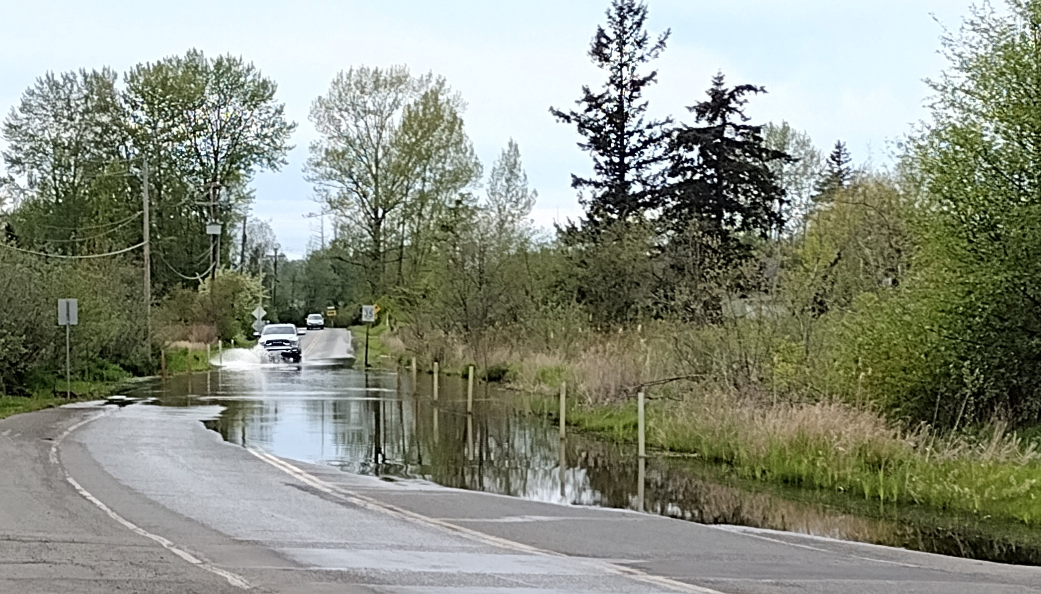
Looks like local road authorities - not sure if that's Whatcom County or the City of Ferndale - may have finally decided to let this section of road sink into the swamp. This is W. Smith Road just past where it turns off from Hovander Road, by the railroad tracks beside Tennant Lake. For decades this area has flooded in the winter, and now the pavement is cracked and sunken in the lowest part of the roadway. This year a large puddle has remained since the flooding in January.

Looking west

These photos were taken on Sunday, when cars and bicycles were still driving through. On Monday the water was deeper and "road closed" signs were posted at both ends. Maybe someday soon it will be a new bicycle/pedestrian trail, with a nice boardwalk above the marshes . . .