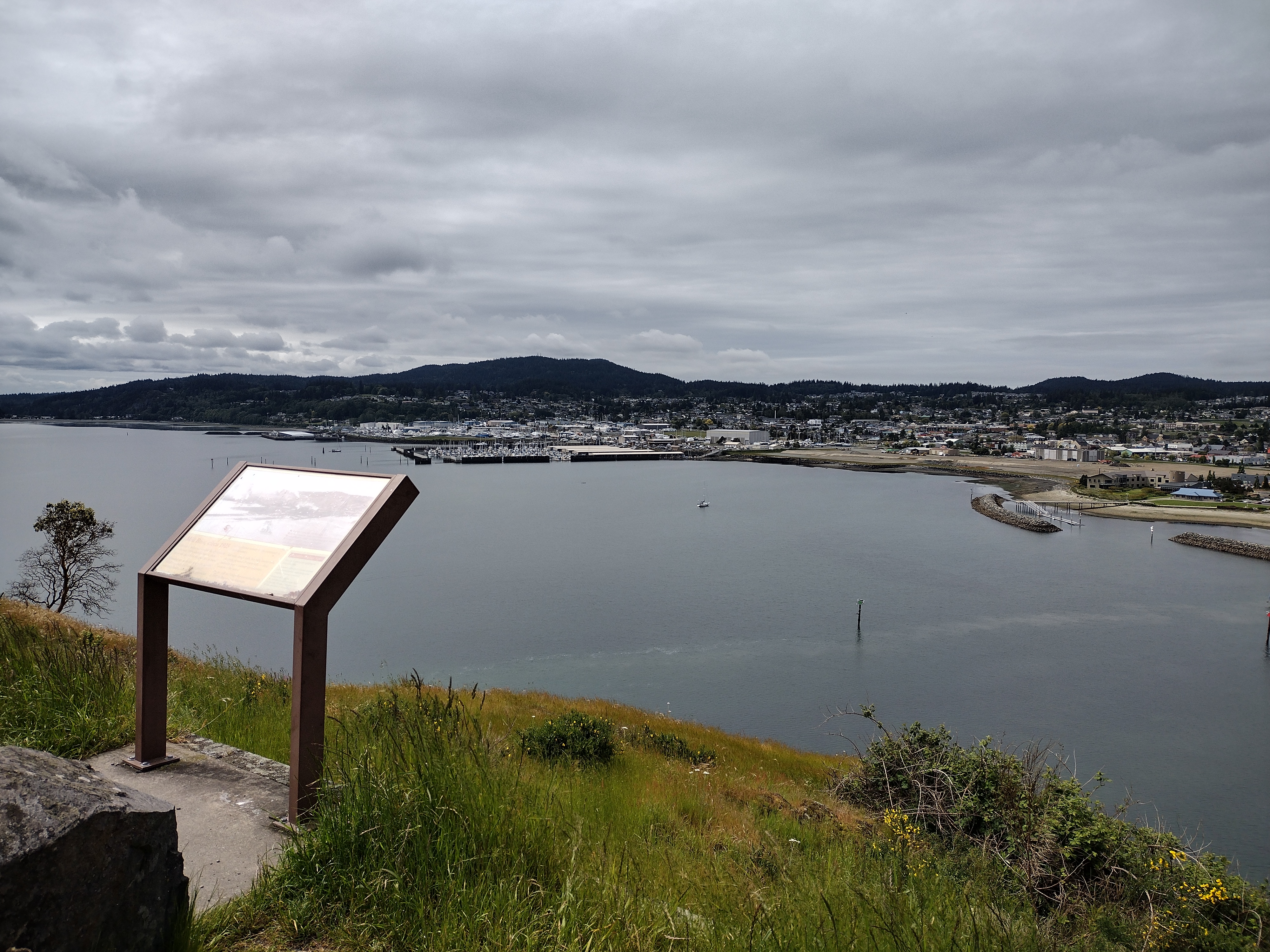
Tuesday, December 20, 2022

Joyeux Noel

7am - 12/20/22
A quick peek out the back door this morning. It's been a month since I've ridden my bicycle, and now my car is buried in snow. I was hoping for one more visit to the local holiday festivals and farmer's markets, but I'll be staying safe at home instead. Rain is predicted for the Christmas holiday weekend. That will be messy.

For several weeks the Ferndale library renewed the David-Dorian Ross taichi DVD's I had been using, but I finally had to return them last week. Now I am back to my own yoga improvisations, and a Bettina Gozo workout DVD purchased via Amazon a while ago. She does short, fast-paced routines, focused on the upper or lower body, or core muscles. They are short enough to finish while I brew and drink my first cup of morning coffee, and intense enough to get me sweaty and out of breath. Yesterday I did a legs-and-lower-back workout that didn't seem too hard at the time, but I'm aching this morning.

It reminded me of the time I did a fitness test before joining a local gym. I had never tried a stationary bicycle, which they used for the cardio test. Starting out I didn't feel any resistance at all from the pedals, so I cranked it up to about 13, which felt about like a bicycle feels on the first few pedal strokes as you get moving. Only I forgot that on a real bike, once you overcome the initial inertia, pedaling gets easier. The stationary bike stayed at 13 for three minutes. That had me sweating and panting by the end, and staggering a bit when I got down from the seat. I completed the tests and they let me in, then I was able to walk the half-mile home. But when I crossed the street I had to use the curb-cut ramps because it hurt too much to step up and down from the sidewalk.

I guess I need to do more. I get out for walks, at least. Here is a collection of festive and scenic photos from various locations, weather conditions and times of day.

Hovander Park sunrise
Ferndale lights have to survive the wind

At the Lynden Fairgrounds


Birch Bay State Park at about 1:30pm, looking roughly southwest.
I'm not sure whether the sun was rising or setting here.

Sunday, November 13, 2022

Between Storms . . .

 . . . I still get out for bike rides about once a week on the sunny days. Between waves of wind and rain storms the days have been sunny but cold and sometimes windy. Yesterday I went for an impulsive ride to Bellewood Farms, a kind of touristy spot on Guide Meridian which specializes in locally made hard apple cider and distilled beverages. They also have a cafe, bakery and gift shop, a pumpkin patch, plus outdoor seating with fire pits, corn hole games and a tot-lot for the little kiddies to play while the grown-ups sample adult beverages.

When I looked up their location online the store website gave the travel distance as about 12-13 miles, but that turned out to be the round-trip distance. Guide-Meridian isn't the nicest bike route around, but I was surprised to arrive at the big red barn less than a half-hour after leaving home. I've never visited Bellewood's shop, though, so I stopped in for some hot apple pie and a look around. There's a well-stocked pastry case, appetizing soup & sandwiches, and tables displaying locally made gift and souvenir items. There's also a distillery on-site, and a cider-tasting event was scheduled for the afternoon, but since I don't drink alcohol I didn't sample those beverages.

Local shops are already setting up for the holiday shopping season. Normally I would complain that it's too early but after a couple of pandemic seasons, the lights, festive decorations and crowds of shoppers at the mall are a welcome change.

After my premature rest break I extended the route a little on Ten-Mile Road, for a 17 mile ride. Along the way I passed by a couple of small apple orchards and fields of young blueberry bushes, with views of craggy Canadian peaks in the distance. Also got stuck behind some trucks hauling manure - the farms are still pungent this time of year. Luckily they turned off after a short distance. Drafting behind farm trucks is not recommended.

Trumpeter swans still gathering in the stubbly fields


Saturday, October 15, 2022

Endless Summer

Autumn crocus
In September I got myself together and started logging some miles, mostly thanks to MapMyRide. Also thanks to some taichi workout DVDs I found at the library, which have helped to strengthen and limber up my neck, spine and hips. Now I'm finally feeling more energetic and getting out for some favorite late-season rides. On Thursday I rode a 40-mile round-trip to Blaine for lunch at my favorite Bordertown Mexican Grill.

Usually I take a zig-zagging route on farm roads, but this time I followed Sunrise Road straight up to H Road, which runs parallel and close to the Canadian border into Blaine. It also has some challenging rolling hills - my speed varied from about 6mph going up, to over 25mph going down. I could have gone faster, but I'm more risk-averse than I used to be and I was holding the brake levers a bit. I took the flatter, zigzag route going home.

The morning started out brisk enough for a jacket and full-finger gloves, but I got warm and sweaty on H Road, and it was warm going home. Also a little hazy from distant wild fires. But a lovely day, pretty fall weather, interesting and entertaining sights, and a nice light lunch in the middle. It was a good day.

Hello!

From across the road, I thought this said "Bud Dood"

Thursday, September 29, 2022

Hills, Trails & Terrain

The weather has been turning crispy over the last week of September. Saturday I realized that I haven't ridden the Interurban Trail yet this summer and might not get another chance before the rains start. In the past I've ridden the whole way starting from Ferndale, making about a 50-60 mile round-trip, but this year my energy level hasn't been up to such a long ride. Instead, I took my bike by car to start from Fairhaven Park, riding only about 16 miles, including a detour into Fairhaven for an affogato to revive me at the finish.

The trail was pretty as ever, the shaded parts cool enough for long sleeves even in the afternoon. At a couple of road crossings there are gulleys that would have had trestle bridges back when the trains were running, but now there are just steep down- and up-hills with a lot of loose gravel. In previous years I've ridden down (and even up once or twice) on skinny tires or on thicker knobby tires, but this time my front wheel slithered around so much that after one try I walked my bike on the steep parts. Not sure whether it was from nerves or poor condition - but the uphill pushes were a good workout for the ol' posterior chain. 

This sign board map is probably out-dated now
Halfway out I stopped at the Fragrance Lake Trailhead lot, thinking I might try riding up the trail for a change, but only about two turns up the hill the upgrade and loose gravel got to be too much for me and I turned down. Instead I went back to Chuckanut Drive, and rode as far as that one viewpoint with the big tree in the middle, where I took in the view of the bay before heading back to town.

When I rode up Lemonade Hill, the last climb on Chuckanut Drive before getting back to Fairhaven, the slope seemed much easier than before, but realistically that's probably because I've usually ridden it at the end of a much longer ride.

On Wednesday when the weather was turning cool and a little cloudy, I went back for another last-chance day trip, to walk the Fragrance Lake Trail that I couldn't ride up. For most of the way the trail is a wide dirt and gravel road, steep enough to make me breath hard at first when walking briskly, but I huffed and puffed until my metabolism got revved up.

For any mountain bikers reading this: Near the start of the trail is a sign where the Double Down mountain bike trail ends, warning hikers not to go up that way because of the chance of meeting fast-moving (out of control) bikers coming down. The foot trail curves around for about a mile and half, until you come to the top of the mountain bike trail, which drops down very suddenly off the main road. Farther up the hill is another mountain bike trail called the Double Black Diamond; I didn't go that way, either.

Bottom of the mountain bike trail
Top of the trail

About halfway up a small landslide has taken out about half the roadway, enough that trail crews couldn't get their trucks past, but it was easy and safe to walk by and continue up to the lake.

Fragrance Lake is really a pond, only about three quarters of a mile around, but it is clear, cool and pretty, with impressive rock formations along side the trail, mostly weathered sandstone that can be crumbled with the fingers. In a few places there are small footbridges over dry creeks that must have been gully-washers feeding the lake during the rainy season.

A few couples sat here and there at the water's edge but I enjoyed quiet and solitude, listening to birds and wind, and once to some sort of purring or growling and chuffing from back in the brush beside the trail - a mountain lion maybe? We gave each other our space. It began to rain lightly as I walked around the lake, but the leaf cover overhead was still dense enough to keep the rain off.

Fragrance Lake
As I walked around the lake at the top of the trail, several times I heard jet airplanes crossing over the bay, and once a helicopter passed by behind a hilltop ridge, probably from the air force base at Whidbey Island. I had a passing thought that maybe they were scrambling for Iran or Ukraine, but some more deep breathing and listening cleared my mind.
dry waterfall by the trail


Thursday, September 8, 2022

Another River Ride

Some photos from another weekend ride on the Nooksack River Trail, past Slater Road. It was a pretty ride with dappled sun and shade, pleasant temperatures and a light sprinkle of rain.

The trail is pretty over-grown with bushes and blackberry vines that will grab your sleeves and scratch your legs. Someone should get out there with a weed-whacker. Also there are some patches of fine sand, not very big but deep enough to grab your front wheel and throw you off the saddle.

At one place where the trail usually washes out during the winter floods, a detour was set up for trail work beyond that point as far as Marine Drive. I had to lift my bike over the sand bags and down about a foot to get to a section of double-track grass and dirt, which was pleasant and easy to ride on my gravel-and-touring bike, but would have been tricky on my Cannondale Synapse. In fact the whole trail would have been hard work on a skinnier-tire bike. Along the way I met a group of older riders - about my age, actually, come to think of it - on fat-tire e-bikes who seemed to find the ride a little rougher than they expected. I guess they thought the electric assist would make things easy, but the heavy bikes must have been hard to manage getting through the sand on the narrow tracks. But we all need to get out there are challenge ourselves!


At a Y-fork in the trail I took the left branch, which looked like it had been recently mowed for the first time that summer and was covered with thick thatch and deep stubble. But it was only a short side-trip, ending at a small pond or puddle in a very fertile wet-land. The reeds and rushes here are impressive, almost two inches in diameter or width. This wet-land area is open for hunting in duck-season, and maybe wouldn't be the best place to ride when people are out with fire-arms.

The rough trail ended here and I turned back and followed the dirt road through the woods to the car-parking lot at Marine Drive, then turned back again toward home.
The bridge at Marine Drive

Monday, September 5, 2022

More Rambling

Now that I've given up my weekday commuting rides, I'm finding that longer rides of 30-35 miles tire me out so I can't do much afterwards. I'm feeling some pain and strain in my tendons and bursa, not muscles or joints. I'm not sure if I'm just out of shape, or if this is arthritis or what is vaguely described as "fibromyalgia." Anyway, it seems better to just take shorter one-to-two hour rides of 15-20 miles three or four times a week, instead of pushing to increase my distances. But it is nice to get going fast enough to get my heart rate up and huff-and-puff a bit. Feels good to get my lungs full of oxygen.

It rained a little on this Sunday ride, and I was forced to take about three detours from the route I meant to ride. First was for a bad car wreck at the railway crossing on Slater Road. No train was involved, but the road was blocked by aid cars and police directing traffic to turn off to LaBounty Drive, which has been blocked off for construction projects most of the summer. I hoped I could squeak through on a bicycle, but no luck, I had to ride across the Slater Road freeway overpass, the one with the dangerous roundabouts where I crashed and tore up my elbow a few summers back. Rather than ride through with vehicle traffic, I crossed the overpass on the wrong side of the road, facing on-coming cars. This turned out to be even more risky, because the white paint stripes marking the bike lane have worn off and cars were cutting very close to the edge of the road. Then out of nervousness I turned off too soon and ended up riding on the north-bound freeway entrance for a couple hundred feet, before realizing my mistake, pulling a U-turn across the lane and going on to the roundabout at the Pacific Hwy. crossing. The pavement here is still cracked, pot-holed and thick with gravel and debris but I made it through and got home safe and with no fresh scars.

So it was an invigorating little jaunt that got my heart beating fast. I am looking forward to riding more in the cooler September weather.

Thursday, August 25, 2022

MapMyRide

When I first started this blog back in 2010 I had hoped to use Google maps to create and share maps of some nice, not-too-hard scenic routes. But I found Google didn't work well on loop routes, it insisted on sticking to there-and-back rides along the shortest distance between points. Which is not the way I roll.

Twelve years later, and now there is MapMyRide. I downloaded it to my phone last month and have been having great fun re-visiting some favorite rides. It uses GPS to track your movement from point to point, and measures distance, average speed and total time. The distance measure doesn't match up exactly with my bike odometer, but I've already discovered that tire tread and inflation have a noticeable effect there. The "pause" button turns off the GPS, but the clock continues running while you stop for a coffee break or passing train, so your speeds will be lower, and total time will be higher than those measured on a bike computer. But I don't really care that much about performance stats, it's the mapping functions I wanted. My favorite feature is the elevation profile, which compares up- and down-grades to your speed, and provides validation that certain hills really are as hard as they feel on the way up.

I have noticed that using MapMyRide makes a difference in my riding habits, beyond just giving me a new incentive to ride. I used to ride out to a destination town like Lynden, Everson, Birch Bay or Blaine, where I would stop at a cafe for a snack and coffee before heading back home. Now I'm tending to ride in a continuous loop, stopping near home for a break if I want one. I even skip bathroom breaks or stops to take photos or window-shop along the way. This may change once the novelty wears off, though.

The dreaded two-roundabout Northwest Drive hillclimb
A rambling ride to Birch Bay State Park

Saturday, July 30, 2022

Hot Tip for Staying Cool

Find your bliss.

Finally, summer weather has arrived. Last winter when my furnace broke down I had no heat during the holiday storms, until my landlord finally installed a new high-tech, programmable thing that also has AC, or some sort of cooling function, for the summer. I haven't really figured out how to set it, though. So far I've been making do by keeping the blinds closed and my apartment shut up while I'm out during the day, then opening up the door and windows and turning on fans to get a cross-draft when it's cooler in the evening. Most mornings I wake up at about 5am and open the door wide to let in some cool air. Since last week day-time temperatures have been in the mid-to-high 80's, though, and that isn't enough any more. I've figured out how to turn on the fan and cooling function on the new furnace (or whatever it is) but it hasn't been very effective. Sometimes it resets itself, and when I check it, I'll find the indoor temperature is set at 82F. I've had trouble sleeping a few nights. Last night I gave up and went out for a late-night stroll at about one in the morning. The night walk was a refreshing change, and it's nice being up early, but then I have to take an afternoon nap.

My best solution for over-heating is an old-fashioned red rubber hot-water bottle, which I fill up with cool water and leave in the refrigerator. Normally I use it for neck and back pain, or for any other sore, swollen joint, but it's perfect for a fast cool-down too. This morning I went for a 30-mile bike ride in the cool part of the morning, but my apartment was pretty warm when I got home around noon, and I was red-hot and dripping with sweat. After a cool shower and a nap, I woke up with a stiff neck and mild headache developing, which can be symptoms of dehydration or heat stress. A cool drink and the cold pack on my head, neck and shoulders cleared that up immediately.

Sunday, July 17, 2022

Eco Adaptations

We may soon see the end of drive-through fast-food as we know it around here - which is fine with me, I hate drive-through lines - but I don't know how Starbucks can go on without super-sized grande plastic drink cups. Seriously, fast food places are going to have to change their business model, and the whole atmosphere of their stores. In the past few years, single-use plastic shopping bags have been outlawed, and non-biodegradable food containers and utensils are going soon - plastic knives, forks, spoons and beverage straws, and plastic drink cups, styrofoam cups, bowls and take-out dishes.

I carry a bamboo spork and knife in my purse, and I guess soon I'll have to bring along a re-usable cup, too. I keep shopping bags in my car, and bought some re-usable mesh produce bags, which I usually forget to carry with me (along with my grocery list, which I leave behind on the kitchen counter).

The plastic bag-ban has been inconvenient because I've always used plastic grocery store bags for my kitchen garbage, rather than buying disposable plastic bags to fill up with garbage then throw away. It takes about a week for me to fill one, mostly with coffee grounds and fruit and vegetable scraps, which are too wet to put in a paper bag. Now I'm using plastic bread or produce bags, but I'll have to find a better solution soon.

In my old job we sold large, decorative re-usable shopping bags for $1.99 or $2.99 or so, and we charged $.08 for big brown paper shopping bags at the cash registers - a state-mandated fee. Many customers argued about the bag-fee, and sometimes when I asked a customer at check-out if they wanted a shopping bag for eight cents, they would say no. Then they would watch the register display as I totaled their sale and ran their card. At the moment the charge went through, they'd say "oh wait, you know, I do need a bag . . ." I once heard a manager ask a customer "do you have eight cents?" but usually I just gave them the bag for free. In fact, I got so tired of the hassles that I stopped asking and charging for bags at all. Over time I single-handedly messed up the store's inventory and re-ordering, and we ran out of shopping bags just in time for the holiday shopping season, except for the expensive decorative gift bags. I'd like to think this made customers regret giving me trouble, but I doubt it.

I'm glad I don't work retail anymore. But I suppose next they'll outlaw bubble wrap.

Friday, July 8, 2022

Centennial Trail - 4th of July

Nakashima Barn
Unexpectedly granted a four-day weekend for Independence Day, I took off for an impulsive and not-very-well-planned ride on the Centennial Trail in Snohomish County, about 50 miles south of Bellingham. The Centennial Trail is an almost-30 mile paved rail-trail that runs between the town of Snohomish at the south end, through Arlington, and almost to the Skagit-Snohomish county line at the north end.

The trail starts at the Nakashima Barn, which is found after a long, meandering drive on Hwy. 9, through wooded country-side, past Lake McMurray. The barn is the last building remaining from the 89-acre dairy farm of the Nakashima family, who were forced to sell the farm in 1942 when they were relocated to an internment camp during WWII. The large family was split up, sent to different camps, and never returned to the county after being released.

I did research the bike trail and the route to the ride start in advance, as I'd been meaning to try this ride for some time, then for one reason or another didn't go. Until Saturday morning, when I gathered up my maps and cue sheets, put my bike in the car, and headed south. Expecting a hot afternoon, I tried to start early, applying a thick coat of sun-block before leaving home. But I also brought along a rain jacket and long-sleeved shrug, which was lucky because the day was chilly and over-cast when I arrived at the barn a little before 11am.

I have ridden through this area a couple of times before. First was back in 2010 when I was returning from Bicycle Mechanic School in Ashland. I had meant to take Amtrak home but when I changed trains in Seattle I wasn't allowed to bring my bike on board. After some argument I got a refund for my ticket and set out to bicycle all the way to Bellingham. I cheated a bit and took my bike on the Swift commuter bus as far as Lynnwood. Then, without a good map of the area, I improvised a route by generally following Hwy. 99 generally northward. A long day, but I made it. The second time was in 2014 when I rode the Red-Bell 100 World Bicycle Relief fund-raiser, which was a much better planned and supported ride.

But much of the route I rode this time didn't really look familiar. True, a lot of the trail is a smooth strip of blacktop beside a mowed-grass equestrian path, bordered by green shrubbery and trees, which kind of all looks the same wherever you are. The Red-Bell 100 had a rest-stop in Arlington, at a city park with a band-stand or picnic shelter. I didn't spot it on my first pass through this time, because it was surrounded by vendors and buskers at a Saturday Farmer's Market, but I stopped for coffee and a snack on the return trip and then recognized the place. North of town, the route runs on wide paved sidewalks along a city street in an industrial/commercial area, with many newer apartment and condo developments that weren't there in 2014.


In Arlington a small bridge crosses over the confluence of the north and south forks of the Stillaguamish River, which creates some interesting currents, sand bars and log jams under the bridge. (This point is also about twelve miles down-river, or down Hwy. 530, from the little town of Oso, which was destroyed in a huge landslide in 2014.)

Pilchuk Creek, 7-8 miles from the barn

I rode about 17-18 miles, to somewhere past Getchell Road - the trail is pretty flat but there are some long, gradual up-grades that can get tiring, especially considering that I had only brought along one water bottle, and no snacks. By this point it was also getting warm and sunny enough to take off my jacket and long sleeves. So I turned back at the top of an up-grade and had an easy coast back toward Arlington for my rest-stop, making a 35-mile round-trip.

I feel a little guilty for driving 100 miles for a 35-mile bike ride, but it was good to have a change of scene for the holiday weekend. If I'd planned better and brought more food and drink I could have made the ride longer, and maybe even found some ride companions to carpool with me. Full round-trip ride would be 60 miles.

Next time.

Not the Farmer's Market, but there was a beer garden

Wednesday, June 22, 2022

After the Flood

Pink dogwood
Hovander Park is the loveliest place in Ferndale for a quick after-dinner walk or bike ride, especially if you include Tennant Lake and the trail along the river to Slater Road.

The gardens have suddenly recovered this week, after the flooding last winter, although many of the farm animals are gone now. The chickens, ducks and geese are still there, and some rabbits, but the goats and their pens are gone. In the old days, the park also kept sheep, cattle, pigs, peacocks, pheasants and other game birds, but those have been gone for years. The Scottish Highland Games will be held at the North Bellingham Golf Course in the future, in pouring rain this year. This will give the park a chance to recover - marching massed pipe bands are hard on the lawns and shrubbery.

This weekend's weather forecast is for our first hot spell of the summer - temperatures in the mid-70's, up to 80 even. Unfortunately, even though I haven't been riding very much I somehow developed a bit of saddle-soreness which I have to let heal up before attempting a long ride. At least I've finally got my new bike adjusted comfortably, apart from the chafing . . .

So in the meantime I'll just enjoy the flowers, on foot.

Highwater mark on 11/11/21


Wednesday, June 15, 2022

Cap Sante - Memorial Day Weekend

Summit of Cap Sante
May and June have been moody months, with days of drenching rain and wind, then a sunny break, then more storms. On Memorial Day weekend, for a change of scene, I took a car trip to Anacortes and spent a day walking around the parks and waterfront.

It's been five years already since the summer I worked at Island Bicycles in the town of Friday Harbor on San Juan Island. That summer I passed through Anacortes at least a couple of times a month, on my way to or from the ferry landing. I bicycled and/or rode the bus between Ferndale and Anacortes and by the end of the summer I was in the best shape of my life. But that was five years ago, and now I'm not.

Back then I would walk or ride my bike on the flat land around downtown, looking up to admire the rocky top of Cap Sante. On foot this time, I decided to climb up to the top - only a few hundred feet. I walked the paved pathway by the marina, out to a viewpoint below the bluff. A couple of short cement stairways lead uphill from the paved footpath, which I assumed logically would put me on a trail all the way to the top. But in the pandemic years, the steep hillside has been heavily used by some very enthusiastic frisbee-golf players. Much of the understory plants have been trampled, leaving large areas of bare dirt between the frisbee targets. Although it was hard to distinguish any particular path, I thought as long as I kept going up I would have to arrive at the top eventually. The hillside got steep enough that I had to look for footholds on roots and rocks, and catch on to tree branches for balance. Then I came to some cracked, jagged bare granite where I wedged my feet and fingers into vertical gaps, climbing twenty or thirty feet to the top of the rocks. Once there I scanned the view of the bay and the town, and also . . . a small parking lot with a bench and viewpoint marker. A narrow paved road goes up the far side of the bluff so you can just take the easy way and drive up to the top.

Panorama view from the top of Cap Sante:

I'd brought a map and compass with me, just to keep oriented, and was surprised to find that the town of Anacortes is actually south of the peak. The shoreline curves and winds around much more than it seems, at least if you're used to thinking in terms of highways running north-and-south.

After admiring the views and exploring around the rocky top of the bluff, I found a gravel trail leading downhill through the woods, which came out by the yacht club - a much easier route than the one I'd taken on the way up. From there I walked around the marina a bit more, then had a very filling fish & chips lunch at The Cabana - under an umbrella, because it was sprinkling a bit.

After lunch I headed (by car) toward the ferry terminal, but this time I followed the road that branches left away from the turn-off to the ferry loading area. I'd always been curious about what lay down this road when I passed through five years ago, but back then I was always too rushed or too tired to explore it by bicycle. The road leads to Washington Park, which has a nice beach area, perfect for Memorial Day family picnics. The sun was shining again, so I walked the beach a bit, and followed a paved road/trail through the park. Along the road there are pull-out areas just big enough for a car/camper, next to grassy waterside picnic areas. I think I walked a mile or two before turning back - it was hard to judge the distance around the whole park, but it would have been a good long hike, and my toes were blistering.
Walking is a good alternative form of exercise and sight-seeing, and it's good to get a break from bicycling, and I'm glad I got to visit some places I'd missed on my bicycle trips. But I've only been riding about twice a week this spring, only 20-40 mile rambles on the weekend. I'm starting to feel a bit decrepit. It's time to start rehabilitating myself. As soon as the rain lets up.

Saturday, May 21, 2022

Signs of Life

Fish tacos & americano

My favorite downtown lunch place, The Bagelry, has reopened. Last week I enjoyed a Saturday brunch sitting indoors out of the rain.

This Saturday was a perfect sunny day for a bike ride to Blaine, for lunch at my other favorite place. To make sure my appetite was keen, I rode a little extra on the sandspit by the marina, out to the public fishing dock. After lunch I walked on the boardwalk on Portal Way, where a summer craft fair and farmer's market was underway.

Seagulls resting on the fishing pier

I usually take a back way to Blaine, out on Enterprise Road as far as Loomis Trail Road, where I turn left and then meander around the farm roads, heading west until I get to the town of Blaine by Semiahmoo Bay and Drayton Harbor. Riding on the inland roads was warm for May, but it was brisk and breezy near the water, and it's fun to go from rural fields and forest to marine views all in one day-trip.

Usually I ride home on the waterside, along Drayton Harbor to Birch Bay, which makes it a longer, hillier ride on the way back. Today I went by the inland route, trying out some different farm roads, to see what things look like going the other direction. This made for a 40 mile ride, the longest I've done since last summer. I'm still adjusting the fit on my new bike - I think I've got it set now, but I am out of shape.  Still, I'm not training for any ambitious rides so I'm free to ramble at will.